While we were souvenir shopping on the islands, Locke introduced me to a renowned Hawaiian singer, Israel "IZ" Kamakawiwo'ole and his cover of "Somewhere over the Rainbow". Listening to Iz's haunting version transports me back to Hawaii and all the incredible experiences Locke & I shared. Both of these great men have since passed away, so all I have now are their memories. May Iz and Locke both rest in peace...
–––––––––––––––––––––––––––––––––––––––––––––––––––––––––––
For more travelling adventures with Locke & I, please check out our Europe journeys at: http://alocke-europe.blogspot.com/
Tuesday, January 10, 2012
Monday, May 25, 2009
2ND TRIP / DAY 6: Going Home
With two wonderful trips in a span of 18 months, it was now time to say goodbye once more to this magical island paradise...
 Aloha and a hui hoa...
>> Al & Locke
All photos in this blog: Copyright – Aloysius, 2007 unless otherwise noted


>> Al & Locke
All photos in this blog: Copyright – Aloysius, 2007 unless otherwise noted

Sunday, May 24, 2009
2ND TRIP / DAY 5: HAWAII ~ Kona & Kohala Coasts
After yesterday's busy journey, today's agenda is simple: visit a Kona coffee plantation and enjoy the beautiful beaches of the Kohala coast.
 Mountain Thunder Coffee Plantation
Hawaii is famous for Kona coffee and to find the coffee plantations, you have to get to a small elevation zone that has sufficient rainfall on the dry Kona Coast. We stop by Mountain Thunder, the largest organic coffee farm in the U.S. What's cool about this farm is that you can roam among the coffee trees and witness the various stages of the coffee bean: from bud to flower to green bean and finally into a mature bean.


Afterwards, we stop by a booth and enjoy the strong aroma of the coffee beans. There were also some chilis that Locke picks up...not quite sure how that plays in the mix, but alas who knows?!?


Hapuna Beach
It's time to relax back at the hotel, so we make a quick lunch stop in Kailua-Kona and head north to Hapuna Beach on the Kohala Coast. Rated as one of the best beaches in the USA, Hapuna has incredibly soft sand and a tide that's not too intense for the young ones. Unfortunately, as I was wondering along the beach, I notice a small baggy-like item with blue stringy things coming out of it. Not sure if it was real or man-made, so I poke at it and it moves – yikes! It's a baby Portuguese man-o-war, and I immediately notify the nearest lifeguard. However, he is quite cavalier about it and doesn't inform the swimming public. I'm hoping there weren't any stings, but with a few other jellyfishes on the beach, I'm sure some of the swimmers weren't as lucky as I was.
 Dinner on the beach
For our last meal in Hawaii, Locke & I splurge a bit and dine on the restaurant patio at the Hapuna Beach Prince Hotel. What's interesting is that as each couple was seated near us, we realized they all were from Japan and each couple was decked out in matching Hawaiian gear. It was quite amusing, but Locke & I nevertheless enjoyed a breathtaking sunset and our best meal of the trip!

>> Al

Hawaii is famous for Kona coffee and to find the coffee plantations, you have to get to a small elevation zone that has sufficient rainfall on the dry Kona Coast. We stop by Mountain Thunder, the largest organic coffee farm in the U.S. What's cool about this farm is that you can roam among the coffee trees and witness the various stages of the coffee bean: from bud to flower to green bean and finally into a mature bean.


Afterwards, we stop by a booth and enjoy the strong aroma of the coffee beans. There were also some chilis that Locke picks up...not quite sure how that plays in the mix, but alas who knows?!?


Hapuna Beach
It's time to relax back at the hotel, so we make a quick lunch stop in Kailua-Kona and head north to Hapuna Beach on the Kohala Coast. Rated as one of the best beaches in the USA, Hapuna has incredibly soft sand and a tide that's not too intense for the young ones. Unfortunately, as I was wondering along the beach, I notice a small baggy-like item with blue stringy things coming out of it. Not sure if it was real or man-made, so I poke at it and it moves – yikes! It's a baby Portuguese man-o-war, and I immediately notify the nearest lifeguard. However, he is quite cavalier about it and doesn't inform the swimming public. I'm hoping there weren't any stings, but with a few other jellyfishes on the beach, I'm sure some of the swimmers weren't as lucky as I was.

For our last meal in Hawaii, Locke & I splurge a bit and dine on the restaurant patio at the Hapuna Beach Prince Hotel. What's interesting is that as each couple was seated near us, we realized they all were from Japan and each couple was decked out in matching Hawaiian gear. It was quite amusing, but Locke & I nevertheless enjoyed a breathtaking sunset and our best meal of the trip!

>> Al
Saturday, May 23, 2009
2ND TRIP / DAY 4: HAWAII ~ Crossing the Big Island (again!)

In the past, the Hawaii Volcanoes National Park "Chain of Craters" Road used to pass thru Kalapana and connect with the Puna District. With Kilauea's relentless lava flows, the Goddess Pele reclaimed a huge swath of land that included many homes in the Kalapana region. Thus, Kalapana Village is pretty much at the end of the road these days and relatively secluded from the rest of the Big Island.
 Lawn Parking
Another unique concept in Hawaii is parking... specifically, lawn parking. It's quite strange: cars park on their respective lawns! As the saying goes, "When in Rome, do as the Romans do", so we lawn park and snap a photo of it!


Instead of the main highway back to Hilo, we opt for the slower coastal road that winds through parts of the Big Island off the radar for many tourists. Unique features include signs warning if you were entering/ leaving the tsunami evacuation area and one lane roads.

Wild tropical fruits: mangos (above) and breadfruit (below)

Other pleasant surprises include our accidental discovery of wild tropical plants bearing fruit along the side of the road. It was interesting to see an abundance of fruit left untouched by the local populace.

Tree Canopies
During our long drives, Locke commented on how much he loved roads that were covered with tree canopies. On our last trip back in Kauai, there was a road near Koloa that reminded him of his youth as he journeyed about Hawaii. So, this time around I stop the car for a photo of this extensive tree canopy tunnel that captures our drives in the Puna District.


Lava Tree State Park
In this state park, lava stumps signify trees molds that were covered by lava, but not completely incinerated by it. The lush park has a plethora of plants and wildlife, and besides Kauai, this was our only sighting of wild roosters on the loose!


On the last trip, I took Locke to an organic Macadamia farm on Moloka'i. On the other side of the spectrum, the mother-of-all macadamia farms is Mauna Loa. During the helicopter ride, we saw its huge presence and so we make a quick pit stop for the most commercialized of all macadamia farms.

In dowtown Hilo, The Hawaii Belt Road makes a sharp left (Route 19 ends and Route 11 begins). This is where Ken's Pancake House is located at. A local joint we found thru serendipity, this place serves up wonderful breakfasts (and other meals too) with a definite Hawaiian & Asian flair.


With our bellies full, it was time to head up the mountain and scale Mauna Kea's peak for a third time (for me). The other times I was up here, thick clouds and rain socked in the summit, so all you could see was about a 1/4 mile in visibility. But the third time proves to be the charm as we were greeted with nothing but beautiful blue skies, sunshine and the Mauna Kea Observatories!

At the top of Hawaii: Cinder cones along Mauna Kea's summit (above) and two of the Mauna Kea Observatories (below)


After enjoying the incredible view atop Mauna Kea, we descend down into Kamuela/ Waimea and the South Kohala District. In this region, the Parker Ranch was established in the mid-nineteenth century with paniolo (Hawaiian cowboys) rounding up the cattle herds. Yup, you've seen the stereotype breakers: snow on Mauna Kea and Hawaiian cowboys in Kamuela – what's next?!?

>> Al
Friday, May 22, 2009
2ND TRIP / DAY 3: HAWAII ~ South Point


We've been here a few times, but something about South Point continues to draw us back here time and again. Sure, it's the southernmost point in the U.S., but that's not the reason. The lure is from the large roaring waves that crash & pound the lava basalt platforms. Along with flowing lava, this is Mother Nature in her rawest form. Like a calling, Locke & I pay another visit, but this time we take off our shoes and explore the basalt platforms in our bare feet. And that's when we make a discovery: a petroglyph!


After our South Point encounter, we depart for the famous Green Sand Beach. I got the the inspiration from a former boss, Tim, but on our last trip, we had a regular car and the road quickly becomes impassable. This time around, we were prepared and rented a 4x4 Jeep Wrangler to ensure we had the right vehicle for the assignment.

Though it is only a few miles from South Point, the road is so rough that it took us quite a while to navigate the soft sands and deep trenches to get out here. First, DO NOT attempt this without a 4x4 vehicle! Second, make sure your 4x4 vehicle has really high clearance, like a Jeep. We saw a few vehicles get stuck and it took them a while to get out of the sands.

When we finally reach the Green Sand Beach, Locke is NOT convinced this is it. He was stubborn about it even though I pointed out the entrance sign and maps! I glance out and explain to him that the green sand is more of a deep olive color from the olivene that precipitated out of the lava. He's still not convinced and it then occurred to me that Locke may have slight color blindness and just could not decipher the subtle green color of the olivene that I could clearly see before me.


In the Big Island's southeastern corner is the Ka'u District, the most remote and rural region. From Hawaii's Belt Road, we saw abandoned pickups and large horses ranches. But, besides tourists, a sighting of a local is as rare as the Nene!
Trekking out to the lava fields
We head back to the Puna District for a hike out to the lava fields before sunset. The hike is a long one and as Locke & I start out on the trek, we observe new life being born on the old lava beds that have since cooled. This was a metaphor for the circle of life: as much as lava destroys life, it also creates new land upon which plants and animals come in to stake a claim. After an hour hike, we get to the beach, but the trek is still at least one more hour beyond this point to the nearest sighting of lava. Given Locke's hip, we take a few photos and opt to turn around. I'm glad that we took the helicopter ride as it turned out to be our only opportunity to view lava!


Thursday, May 21, 2009
2ND TRIP / DAY 2: HAWAII ~ Helicopter Aerial View
Hawaiian Lava
This was our main mission for coming back to the Big Island: to see lava! Though Kilauea Crater has been steadily pouring out lava since 1983, there are periods of high activity as well as lulls...so luck & persistence are more of a factor if you get to see lava or not.
A little history...
Back in 1992, I backpacked around the Big Island and one of my best memories was the trek out to see the flowing lava. Mind you, this was an all-day trek taking our small group about 4 hours just to reach the lava. While it was exhausting, the close encounter with the lava was incredibly exhilarating! In those days, the type of lava flowing was of the a'a variety, which was very slow and lumpy. Thus, unless you were vegetation or a snail, pretty much any living thing could get out of its way. Still, a'a lava is friggin' hot and I remember screaming at my buddy to take the darn picture of my 3' closeup with the lava!
However, in recent years the lava has metamorphisized from the slow-moving a'a form into the fast-moving pahoehoe type that flows swiftly. The problem with pahoehoe lava is that tourists often get too close to the edge or the hardened lava they are standing on will suddenly give way without warning. Several incidents have occurred where hikers have been badly burned or even killed. After these incidents – and lawsuits, I'm sure – park rangers now strictly regulate access to the lava. So, Locke & I book a helicopter ride for a view from above and will try and make a trek if the park rangers allow us.
 Helicopter Ride
Linear lava tubes protrude into the ocean, creating immense steam when directly interacting with the cool ocean water...

Lava skylights
Another feature are the lava skylights. These are formed when hardened lava on the surface collapses, revealing the flowing pahoehoe lava underneath. Remember my mention of hiking dangers? Skylight collapse is the main culprit for the unfortunate hiker as it is unpredictable and sudden. Anyway, for this flight we spot two skylights, and this will be our only direct sightings of lava flowing...
Pu u 'Oo Vent
Last stop in the volcano area is the Pu u 'Oo Vent. Though Kilauea Crater is considered the mother site of the latest lava eruption, most of the recent activity has been occurring at or near Pu u 'Oo.

Lava skylight (above) and Pu u 'Oo Vent (below)

 With the volcano tour complete, we fly over points of interests including the Mauna Loa Macadamia Farm, various Hamakua Coast waterfalls and downtown Hilo. In the picture of Hilo (right), note the breakwater in the far distance... this was built in response to the 1946 & 1960 tsunamis that destroyed much of the city.
 Downtown Hilo

University of Hawaii – Hilo
We make another stop on the University of Hawaii-Hilo campus. A unique architectural feature is the 'Imiloa Astronomy Center with 3 titanium cone roofs marking an intriguing, yet completely un-Hawaiian style. For some reason, it reminds me of Madonna's cone bras!

Locke has a friend in town and we have an invite to stop by during a house party. We got to meet & greet so many locals and had a great time!
>> Al
Wednesday, May 20, 2009
2ND TRIP / DAY 1: HAWAII ~ Crossing the Big Island
Returning for lava
As I previously mentioned at the conclusion of our last trip, Locke & I sensed that we would be coming back to Hawaii...I just didn't think it would be only 18 months later! When we were last on the Big Island, the goddess Pele was not cooperating and the lava not flowing in vast amounts for anyone to see.
Since then, a new episode of lava flows erupted and we were convinced that this would be a good opportunity for us to head back to Kilauea to catch a glimpse of Mother Nature at work...
 Kona International
Besides Honolulu, there are now direct flights from California to Maui and Kailua-Kona. So, we fly direct to the Kona Coast on the leeward side of the Big Island. When we land, we notice some interesting cultural icons in the courtyards. The first is a hula statue, and I pull out my camera for a photo. I'm very inspired, since I just joined a halua hula (hula school) called Na Lei Hulu I Ka Wekiu in San Francisco. We then spot a large tiki statue in another courtyard and check it out. According to Hawaiian superstition, taking small items from Hawaii (i.e. tiki statues, lava, petroglyphs, etc) brings bad luck to the one who takes it. So, we opt for some pictures instead, make a reservation for tomorrow's helicopter flight and then get our rental car.

Geography
While the other Hawaiian islands are defined by their coasts (i.e. Coconut Coast, Leeward Coast, etc) or shore (for Oahu only) the Big Island is so large it is defined by districts (clockwise from Kona): South & North Kona, South & North Kohala, Hamakua, North & South Hilo, Puna, and Ka'u.

Hamakua District
After our brief stop in Kamuela, we make the long trek along the Big Island's north coast and transition from West Hawaii's dry, leeward side into East Hawaii's rainy, windward side. Due to Mauna Kea, the transition happens fairly quickly and my memories of Hamakua are relentless rains for the rest of the drive into Hilo.
Hilo
We stop for lunch at Hilo Bay Cafe, our favorite restaurant on the Big Island. Since it's raining, there's not much to do, so we head out to the Puna District on the far eastern part of the Big Island.
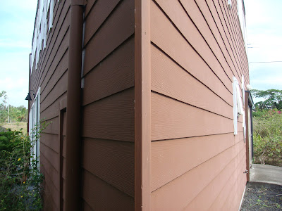
 Puna District Rental
The Puna District encompasses a lot of the agricultural farms in East Hawaii, but most visitors pass through it on their way to a single destination: Kilauea Crater and Hawaii Volcanoes National Park. Locke reserved a small cottage for rent near Kalapana on the coast and when we get there it is simply amazing! Architecturally, I'm quite intrigued and start snapping photos less from a tourist viewpoint, and more from a local perspective. The house is shaped like a triangle with a simple two-story open floor plan: kitchen/dining/living room downstairs and the bedroom and parlor upstairs.
 Along with many homes in the Hawaiian islands, areas that have abundant rainfall utilize an interesting water system: your own water tank in the yard! It's actually very common in Hawaii given that there isn't other abundant water resources such as large underground aquifers (many parts of US), man-made lakes (Texas), rivers (Southwest US) or a huge snowpack (California) that many of us on the mainland side take for granted. Another intriguing note: since we're in Hawaii, why not grown your own pineapple in the yard, right? Yup, out in front, we had a few plants with immature pineapples growing!

>> Al
As I previously mentioned at the conclusion of our last trip, Locke & I sensed that we would be coming back to Hawaii...I just didn't think it would be only 18 months later! When we were last on the Big Island, the goddess Pele was not cooperating and the lava not flowing in vast amounts for anyone to see.
Since then, a new episode of lava flows erupted and we were convinced that this would be a good opportunity for us to head back to Kilauea to catch a glimpse of Mother Nature at work...
 Kona International
Besides Honolulu, there are now direct flights from California to Maui and Kailua-Kona. So, we fly direct to the Kona Coast on the leeward side of the Big Island. When we land, we notice some interesting cultural icons in the courtyards. The first is a hula statue, and I pull out my camera for a photo. I'm very inspired, since I just joined a halua hula (hula school) called Na Lei Hulu I Ka Wekiu in San Francisco. We then spot a large tiki statue in another courtyard and check it out. According to Hawaiian superstition, taking small items from Hawaii (i.e. tiki statues, lava, petroglyphs, etc) brings bad luck to the one who takes it. So, we opt for some pictures instead, make a reservation for tomorrow's helicopter flight and then get our rental car.

Geography
While the other Hawaiian islands are defined by their coasts (i.e. Coconut Coast, Leeward Coast, etc) or shore (for Oahu only) the Big Island is so large it is defined by districts (clockwise from Kona): South & North Kona, South & North Kohala, Hamakua, North & South Hilo, Puna, and Ka'u.

Map courtesy of Maui Real Estate.net
After our brief stop in Kamuela, we make the long trek along the Big Island's north coast and transition from West Hawaii's dry, leeward side into East Hawaii's rainy, windward side. Due to Mauna Kea, the transition happens fairly quickly and my memories of Hamakua are relentless rains for the rest of the drive into Hilo.
Hilo
We stop for lunch at Hilo Bay Cafe, our favorite restaurant on the Big Island. Since it's raining, there's not much to do, so we head out to the Puna District on the far eastern part of the Big Island.

The Puna District encompasses a lot of the agricultural farms in East Hawaii, but most visitors pass through it on their way to a single destination: Kilauea Crater and Hawaii Volcanoes National Park. Locke reserved a small cottage for rent near Kalapana on the coast and when we get there it is simply amazing! Architecturally, I'm quite intrigued and start snapping photos less from a tourist viewpoint, and more from a local perspective. The house is shaped like a triangle with a simple two-story open floor plan: kitchen/dining/living room downstairs and the bedroom and parlor upstairs.

 Along with many homes in the Hawaiian islands, areas that have abundant rainfall utilize an interesting water system: your own water tank in the yard! It's actually very common in Hawaii given that there isn't other abundant water resources such as large underground aquifers (many parts of US), man-made lakes (Texas), rivers (Southwest US) or a huge snowpack (California) that many of us on the mainland side take for granted. Another intriguing note: since we're in Hawaii, why not grown your own pineapple in the yard, right? Yup, out in front, we had a few plants with immature pineapples growing!
>> Al
Subscribe to:
Posts (Atom)